


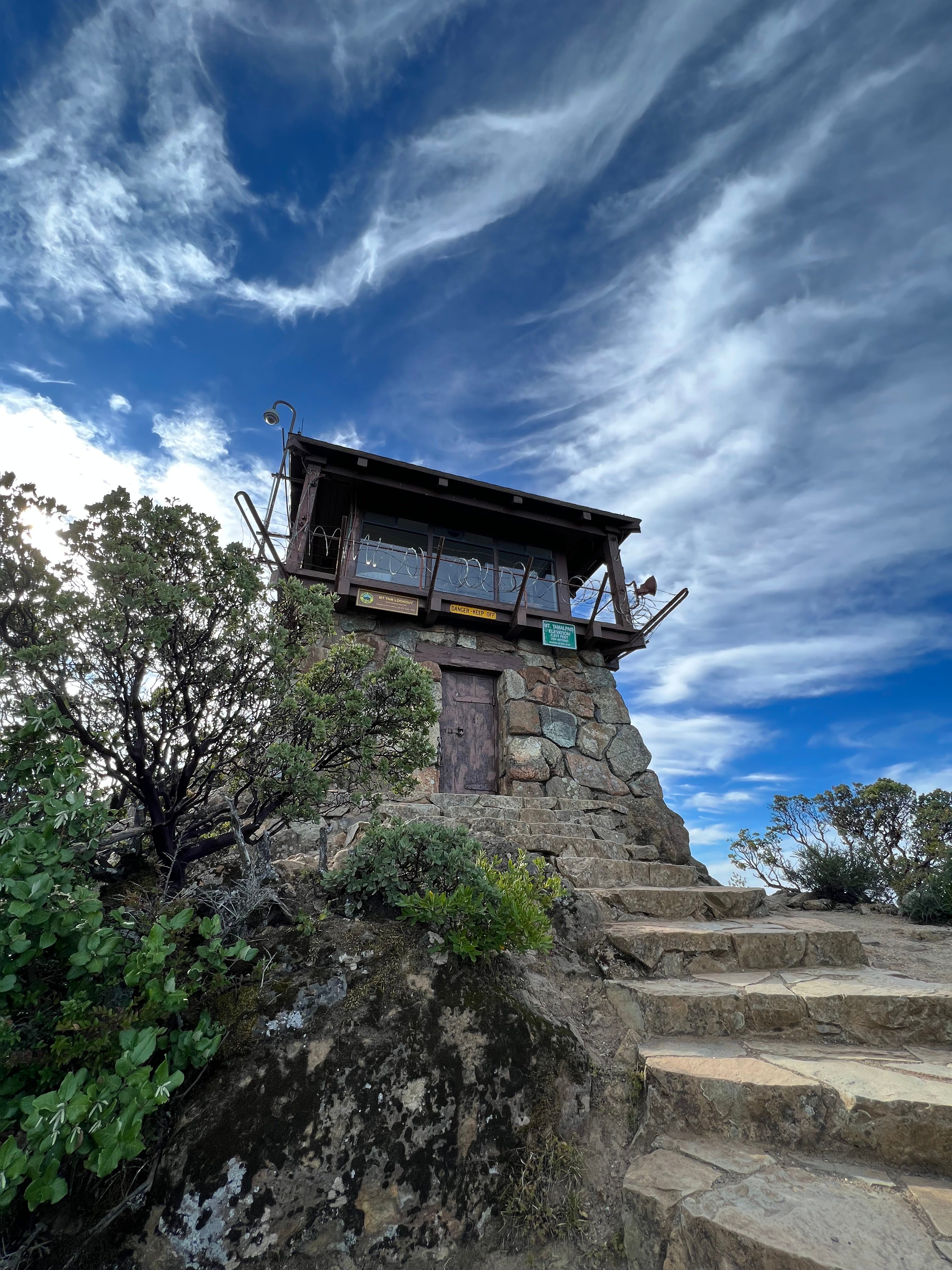
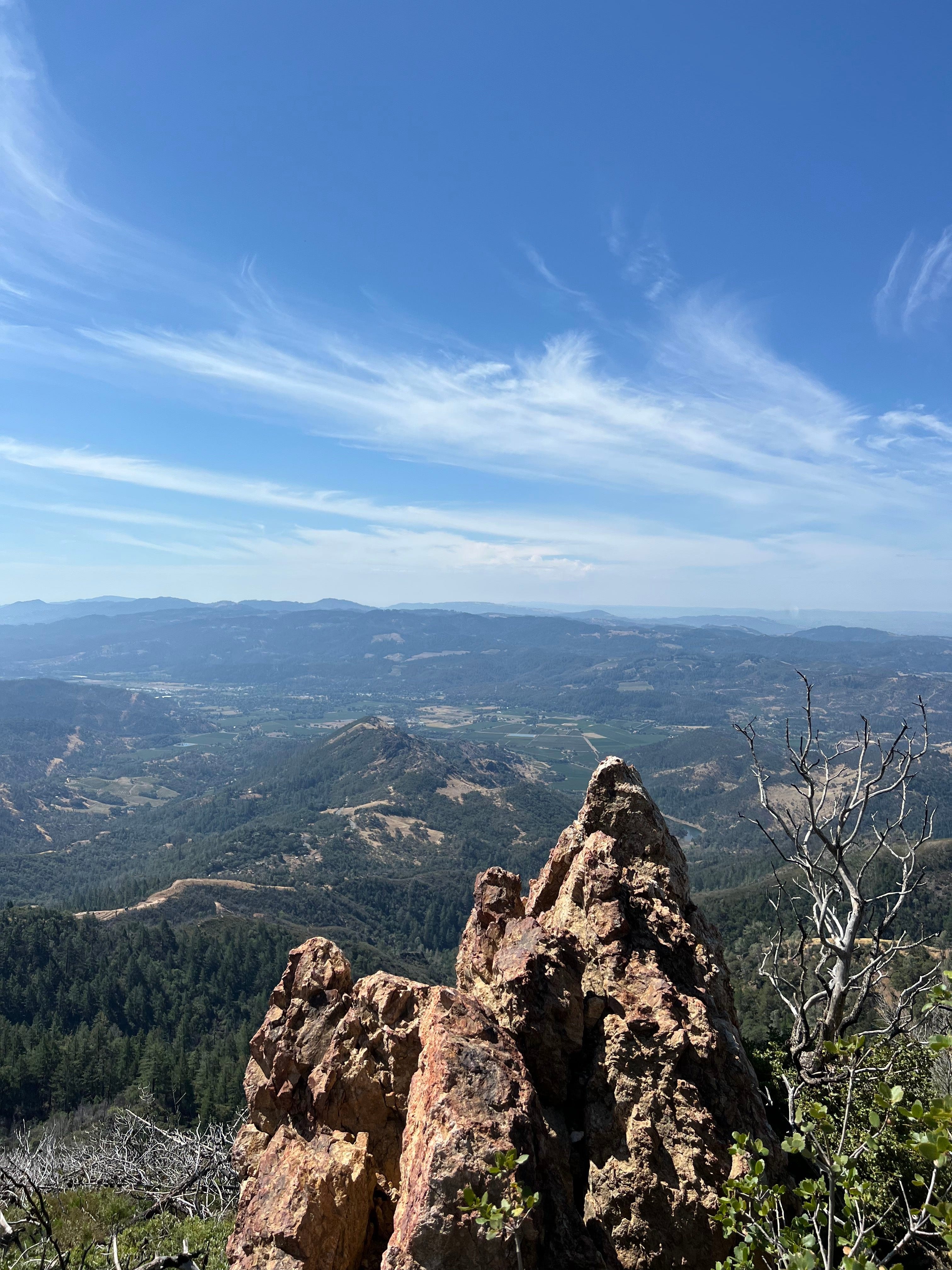
Perched on a boulder atop the Middle Peak of Mt. Tamalpais, I looked out to the northernmost stretches of the San Pablo Bay, glimpsed the East Peak — crowned by the fire lookout — from this never-before-seen view, spied Angel Island, Alcatraz, the Bay Bridge, the skyline of downtown San Francisco, the Headlands obscuring all but the top of the Golden Gate Bridge, Sutro Tower — like some giant fork — sticking out of the hills, the coast all the way down to Pacifica and finally out to the Pacific Ocean disappearing in a blue and white haze, and I couldn’t believe how quiet it was as I stood on the roof of the world.
It was serendipity that I’d arrived on the Middle Peak at all. When I’d set out from the trailhead just below Phoenix Lake some two-and-a-half hours earlier, the East Peak fire tower was my unequivocal destination. The thought of a detour hadn’t even crossed my mind. But, just after reaching the ridge, I looked down at my All Trails app and realized how easy it would be to dart up to the Middle Peak, the only of Mt. Tam’s three summits that I’d never actually visited.
I had to explore.
My timing was impeccable, it turns out. Moments later, after marveling at the view, the first of three giant trucks rumbled up to the top of the mountain to work on what I could only imagine was some sort of construction or maintenance project. After letting the trucks drive past, I continued on to the East Peak, which claims its own stunning, 360-degree views, where I ate lunch on the rocky outcropping directly below the Gardner Fire Lookout. I then hurried down the mountain to complete the more than 14-mile loop, my hike up — and down — the far side of Mt. Tam.
I’ve now hiked four of the six mountains that make up the annual NorCal Six-Pack of Peaks Challenge — a challenge that has introduced me to a couple of impressive local peaks I’d never heard of and another I’d rather never visit again.
I started off with Mt. St. Helena — 80 miles north of San Francisco, looming over the vineyards of Calistoga — which stunned me with its utterly unfamiliar landscape, so desert-like and rocky with lizards scrambling across the path. Had I hiked it in November, I would have encountered snow. But, on that Tuesday in early August, as I trudged along the fully exposed fire roads, the temperature climbed to 82 degrees — hot enough that, at the time, I remarked, “Not out of the question I just pass out.”
Near the bottom of the mountain, I detoured off the trail to a lookout only to notice there was a hole in the ground. I realized I’d stumbled across the Silverado Mine — a long-since defunct silver and gold mining camp. Peering into the mine shaft, I couldn’t see where it ended. I was tempted to go in, but worried I’d fall and never get out.
Two days later, I woke up and decided I’d hike Mount Umunhum — a one-of-a-kind peak in the Sierra Azul Open Space Preserve, a 19,300-acre wilderness located on the eastern edge of the Santa Cruz Mountains. On the top of Umunhum is “the Cube,” an eight-and-a-half-story concrete box, a vestige of the Cold War. The Cube was once a radar tower, part of the demolished Air Force base, scanning the sky, looking out for enemy aircraft.
While eating lunch on the summit, I could see Mt. Tam up north, San Jose — nothing but a cluster of office buildings bunched together — some 3,400 feet below and off to the east two tiny white dots, the observatories of Mt. Hamilton. Somewhere, beyond the hazy clouds of the horizon was Mt. St. Helena, too far off to be seen.

About six weeks later — I was pleasantly detoured by exploring the shores of Lake Champlain in Vermont, a minor bout of altitude sickness on Mount Barcroft in California’s White Mountains (which, at 13,054 feet, is the highest elevation I’ve ever been), walking along the beaches of Avalon and Stone Harbor in New Jersey and an impromptu day trip to Pinnacles (the wildly underrated national park) — I finally conquered my third peak, Mt. Sizer. In the immediate aftermath, I accurately, if not so diplomatically, called it the “most f*cked up hike of my life.”
I knew I was in trouble when, after a quick climb through the forests of Henry W. Coe State Park, I found myself descending an alarmingly steep downhill. The 16.15-mile hike was a never-ending series of ups and downs — of fighting to claim hundreds and eventually thousands (4,312 to be exact) of feet of elevation just to promptly, and repeatedly, give it all away. To make it worse, amid one particularly unrelenting climb, it felt like I was hiking through flour. The trail was powder. Every step released a cloud of dust as if a grenade had just been detonated in a desert dune.
The peak — which was really just a long, rolling ridge — was unmarked, but I think I found it. Remarkably, I could see all the way out to the Sierras. I had planned to stop at the visitor center (an old, converted farm) to buy a sticker when I was done, but I was so annoyed by the experience that I just went home.
With two peaks and a little more than a month to go, I’ve now hiked 50.75 miles and climbed 10,729 feet.

Share this post