


The Cow That Almost Killed Me

I awoke in the middle of the night to find the revolt had blossomed into a full-on rebellion — my body, at the worst possible moment, had mutinied against me.
In three and a half hours, I was due to jump out of bed, drink my iced coffee, solve Wordle and head over to the East Bay where I’d meet my parents to hike Mount Diablo, the sixth and final climb in the Bay Area Six-Pack of Peaks Challenge.
A month earlier, I’d completed the fifth peak, ranging across the Sunol and Ohlone Wilderness Regional Preserves. The sky was an unfamiliar color as I set off so early, crossing the Bay Bridge just before 7 a.m., the white tower at the center of the span rising 525 feet in impressive fashion. As I drove toward the trailhead in Sunol where I’d begin my hike to the top of Rose Peak, I realized I hadn’t left nearly early enough to beat the traffic. Bobbing along in the ebb and flow of the 680 backup, I couldn’t help but think how unpleasant it would be — on a molecular level — to start one’s day like this as a regular routine.
I felt immediately better once I’d exited the freeway and began speeding along the country road, cows grazing on the hillsides, not a car in sight. While I was extolling the virtues of the wilderness, I had completely forgotten how dangerous it can also be — how quickly and unexpectedly you can be plunged into a life-or-death situation as I was about to find out.
The temperature had dropped to 38 degrees by the time I parked my car and crossed the bridge spanning Alameda Creek, walking into the wilderness. Passing through the area known as Little Yosemite, there were so many rocks to scramble up, but I had to remind myself that today was not a day for detours — there would be plenty of exploring to do on the more than 18-mile, 4,100-foot trek that lay ahead of me.
Once you read the absurd details of what happened next, it might be difficult for you to grasp the sudden, sheer, unimpeachable panic that washed over me as I looked out across the meadow and noticed the powerful hind legs of what seemed to be a cow grazing in the bushes only to realize it was actually a mountain lion.
I was terrified.
And what could I possibly do? One of the steepest climbs on the trail lay ahead of me and the trailhead was miles behind. Even if I did get away from this mountain lion before it bounded the 50 or so yards that stood between us, how would I know it wasn’t simply stalking me from the bushes — unseen? I was about to get murdered by the world’s largest mountain lion. And it was a literal lion. It was huge. If I was going to get eaten, at least I was going to get some content out of it. But I couldn’t even manage that. Instead of filming the lion, I’d left my camera on for a minute and 18 seconds, recording half my hand and an upside-down landscape, as I marched away, panicked — and panting heavily — before finally turning around.
Before fleeing, I’d been shocked by how slowly this predator moved, how seemingly unbothered by me it was. And how, I wondered, had I seen it, before it saw me?
Looking back over my shoulder, the lion, I saw, had barely moved. But now it was unobscured by the bushes, standing in the clearing. In that moment, it all came together. This was no lion. It was a tan cow — its coat an uncanny match for the dried-up brush all around.
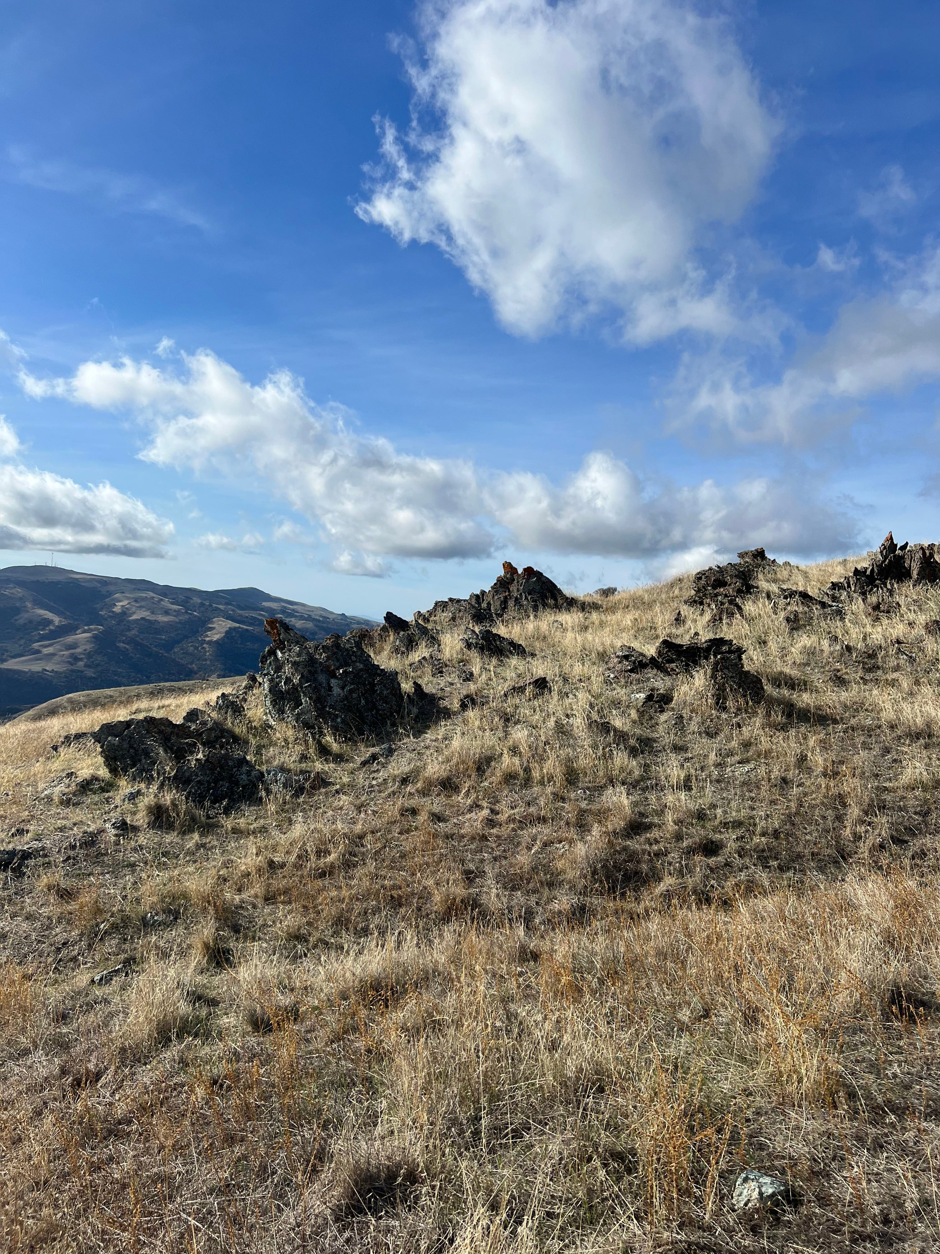
I was absolutely rattled as I went through the gate, leaving behind Sunol for Ohlone. I signed my name in the wilderness log, complete with a time stamp, alerting the rangers to my last known location should I get lost — or get eaten by a lion. I climbed past Hawk’s Nest and Eagle’s Eyrie — two names right out of Westeros — and arrived on a ridge where I had stunning views stretching out in all directions. Off in the distance, I could see the tops of the Santa Cruz Mountains.
I kept getting trapped under blankets of clouds — some big gray ominous ones were all but scraping against the surrounding peaks. As I made the final ascent, I could see the giant white windmills of the Altamont Pass and what I imagined, what had to be Mount Diablo looming way up north, banks of clouds speeding past.
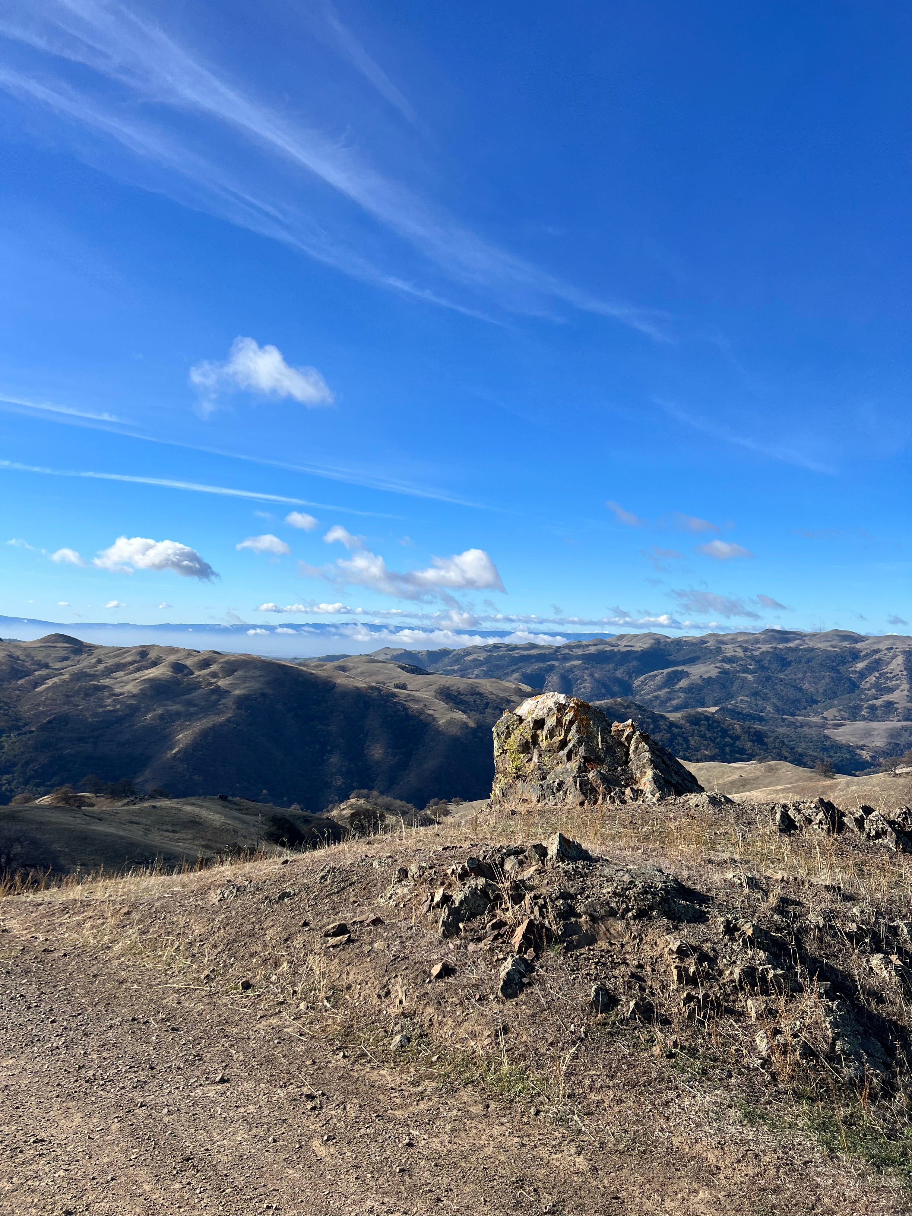
I arrived at the summit right at 11:50 a.m. — well ahead of the 1 p.m. turn-around time I’d set for myself to ensure I would avoid darkness on the way back down. I didn’t even spend 15 minutes on the peak and I’d hoped to spend five. The view was far from the best I’d seen on the way up. It was foggy, cold — 46 degrees — and the wind was biting.
As I flew back down, escaping the clouds, I felt strong, hopping over a cattle gate that I couldn’t manage to open. Just before completing the 18.8-mile, 4,162-foot out-and-back, I jotted down a final honest if bold note, “Dare I say, this hike is easy.”
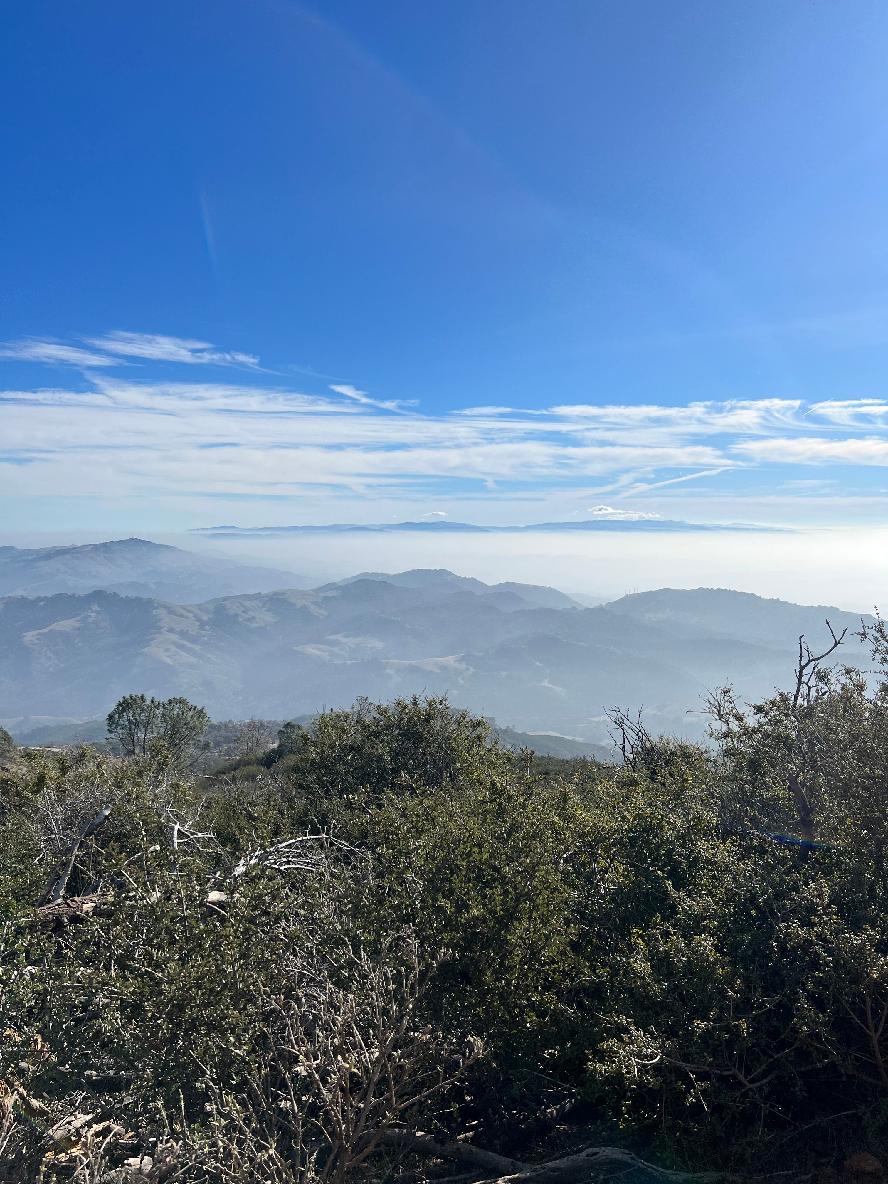
It was a hazy day as we set off for the top of Mount Diablo, the mountain famous for its sweeping views. There’s a rumor — dating back to the 1850s and ‘60s when geologists first surveyed the mountain — that Diablo has the largest view in the world except for Mount Kilimanjaro. Regrettably, that’s not true.
But, on a clear day, you can see 40 of California’s 58 counties, the Golden Gate Bridge, the Farallon Islands, Mount Lassen, the Sierra Nevada and even Yosemite. Sentinel Dome can be glimpsed with binoculars, but Half Dome is blocked from view.
On a hazy day, like the one we found ourselves hiking on, the viewshed is significantly smaller but still spectacular. Climbing higher and higher, I wasn’t sure exactly what I was looking at, but the tops of so many unknown mountains peeked out amid the sea of fog, like islands on the ocean.
I’d woken up that morning feeling — technically speaking — like shit.
For the second time in as many boosters, the shot had wiped me out. Just before bedtime, I felt the symptoms setting in. Three to four hours later, those symptoms — headache, full-body weakness and fatigue — had gotten so bad that they woke me up. And wouldn’t let me fall back asleep. Instead, I spent most of the rest of the night tossing and turning trying — futilely — to find a comfortable position.
If I was going to complete this hike and, by extension, the Six-Pack of Peaks Challenge, today was the day to make it happen. The end of the year was fast approaching and with the holidays and travel plans crowding the calendar, it was now or never. It’s not like I’m going to be able to sleep, or even rest comfortably in this condition, I reasoned. So, with the indispensable assistance of a bacon, egg and cheese bagel, I rallied.
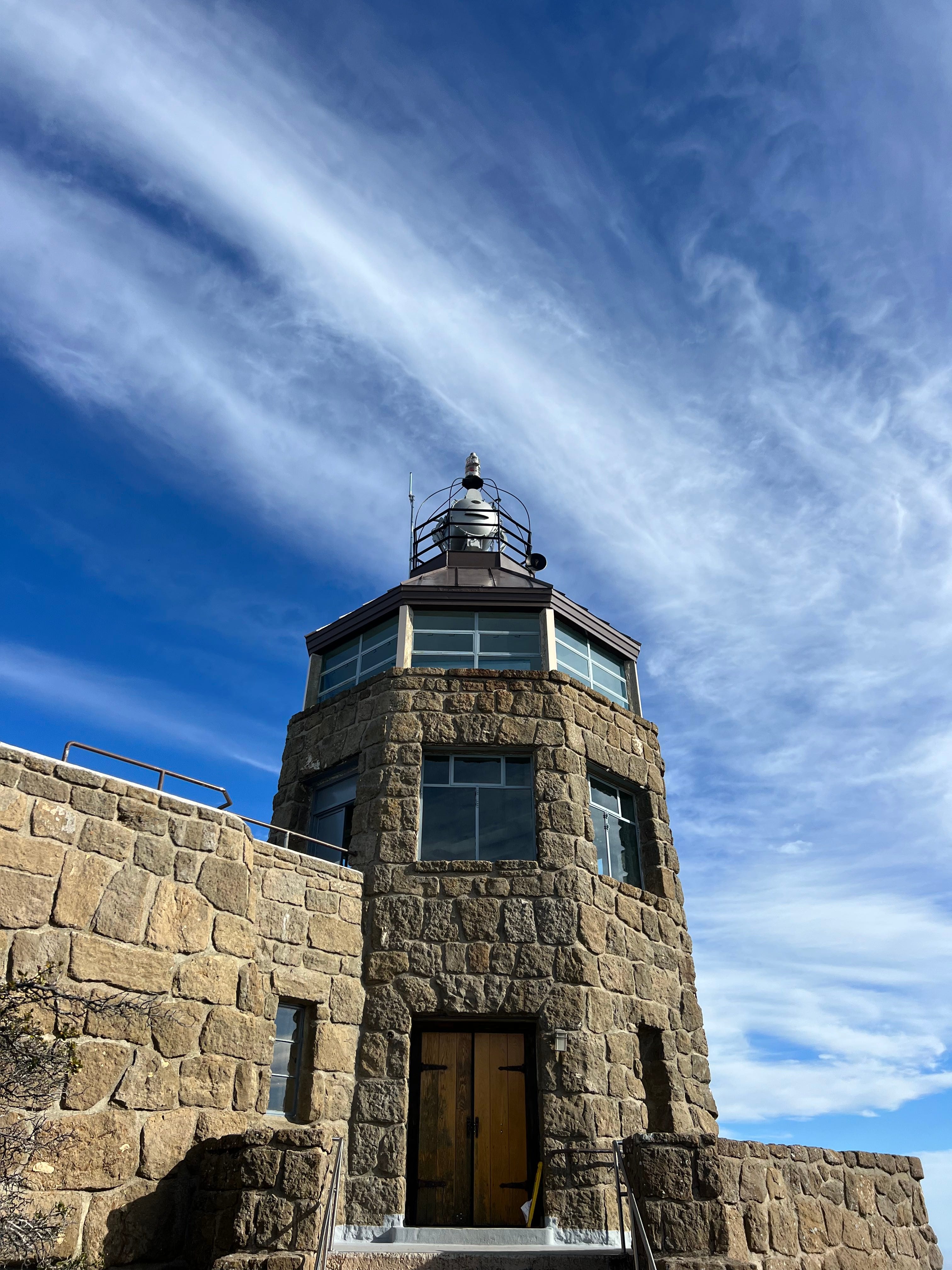
Just beyond the simple metal sign — Summit Elev. 3849 Ft. — and the parking lot (after all it is far too easy and common to drive to the top of the mountain) there is an impressive stone building complete with a tower, which is reminiscent of a lighthouse. In a way, it sort of is, or was.
The Mount Diablo Beacon, as you can read on a handy plaque, is topped with a light that boasts the power of 10 million candles. It used to guide planes in the night, but it was switched off after the 1941 attack on Pearl Harbor for fear it would unintentionally light the way for enemy aircraft. Now, it’s only illuminated on special occasions to honor veterans. These days, there’s a view deck, you can stroll into the glass-encased tower and even go downstairs to explore the Mount Diablo Summit Museum, which includes a marker for the true high point of the mountain.
Heading down Diablo, a sliver of Mt. Tam — only the summit — suddenly emerged. I thought I might have briefly seen Sutro Tower, a tiny fork, amid the haze. Or maybe I dreamed it.
I thought back to the start of the challenge, six months earlier, when I drove up to Mount Saint Helena, following Highway 29, a gorgeous mountain road that wound up and out of the valley, past and eventually above the vineyards of Calistoga. I had seen so much, explored so many corners of the greater Bay Area that I previously knew so little about. I’d hiked 77.55 miles. I’d climbed 17,150 feet.
Walking the final stretch of the dirt track, I felt triumphant — my feet keep moving and my mind just floated away.